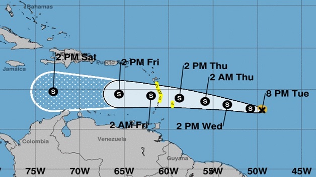
The St. Vincent and the Grenadines Meteorological Services continues to closely monitor Tropical Storm Bret. At 5pm on Tuesday, the centre of Tropical Storm Bret was located near 12.2N, 48.6W or 840 miles east of the Windward Islands.
Maximum sustained winds is 45mph or 75km/h and is moving west at 18mph or 30km/h. Although the present movement is to the west, model guidance is indicating a west-northwest movement of the system as it nears the island chain, which might place the centre to the north of SVG.
For such, no tropical watch or warning has been issued for Saint Vincent and the Grenadines, but further monitoring will be done. Given its speed, the system should pass SVG around Thursday evening into Friday.
Model guidance is indicating roughly 1 inch (25mm) by early Thursday night, and a further 2-3 inches (50mm-75mm) from Friday into Saturday. These showers can be accompanied by isolated thunderstorms. A flash flood watch may be issued during this period.
Seas will gradually deteriorate on the eastern coasts with swells peaking at 3.0m, retreating during Friday. A marine advisory will be in effect on Thursday for above normal seas swells.


