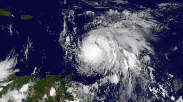
At 11 am, the centre of Hurricane Maria, now category 3, was near 14.7°N 60.1°W or about 130 miles (209 km) to the north -northeast of Saint Vincent and the Grenadines; moving west-northwest near 10 mph (17 km/h) and this motion with a decrease in forward speed is expected through Tuesday night. Maximum sustained winds have increased to near 120mph (193km/h) with higher gusts. Minimum central pressure was 967mb or 28.32inches. Hurricane-force winds extend outward up to 15 miles (30 km) from the centre, and tropical-storm-force winds extend outward up to 125 miles (205 km).
For such, occasional gusty winds with very rough seas and feeder bands are of greatest concern to Saint Vincent and the Grenadines. Occasional strong westerly to south- westerly winds 20 – 30 mph (32 – 50km/h) with higher gusts is forecast for today, especially for the northern portions of the islands. Pockets of moderate to heavy showers, periods of rain, thunderstorms and gusty winds are already happening across SVG and forecast to continue on Tuesday and Wednesday.
Rainfall accumulations of 4 – 8 inches (100 – 200 mm) from today through Wednesday are possible, with higher amounts in mountainous areas.
Seas across SVG are now expected to be at least 4- 6 metres (13ft-20ft), especially on northern coasts of mainland, with life-threatening surf and rip current conditions. Maria is intensifying rather quickly and as it moves away from Saint Vincent and the Grenadines, northerly swells are expected across St. Vincent and the Grenadines on Tuesday and Wednesday.
A Flood Warning is in effect until 6:00pm today, Monday 18th, 2017
The High Surf Advisory and Small Craft Warning remain in effect.
Sea bathers and other users of the sea should stay out of the water.
Persons near rivers, streams and coastline areas prone to flooding and land slippage, should take precautions.


